Geoportal: a tool to understand the impacts of climate change in the Pyrenees
The geoportal has been developed by the OPCC as one of its most powerful tools for providing the general public with access to crucial data on the impacts of climate change in the Pyrenees.
The layers of geolocated information available in the portal are complemented over the years by the OPCC’s partner projects conducting crossborder research on both sides of the Pyrenees.
The geoportal allows citizens to discover the impacts of climate change on their territory, based on various indicators such as anomalies in minimum and maximum temperatures, rainfall and rates of innivation (time of retention of snow on the ground) depending on the season, or annually.
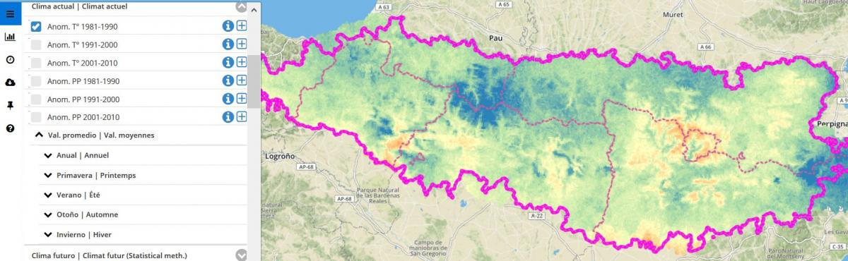
Below, temperature anomalies are observed between 1981 and 1990, with a tendency towards lower temperatures, up to -1º for the bluest areas:
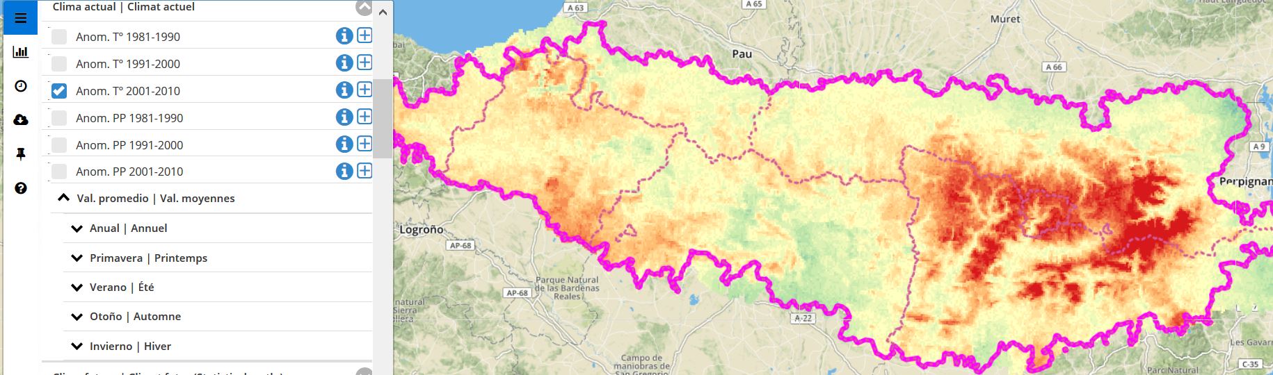
And here you can see the temperature anomalies between 2001 and 2010, with a tendency to an increase, up to +1º for the reddest areas:

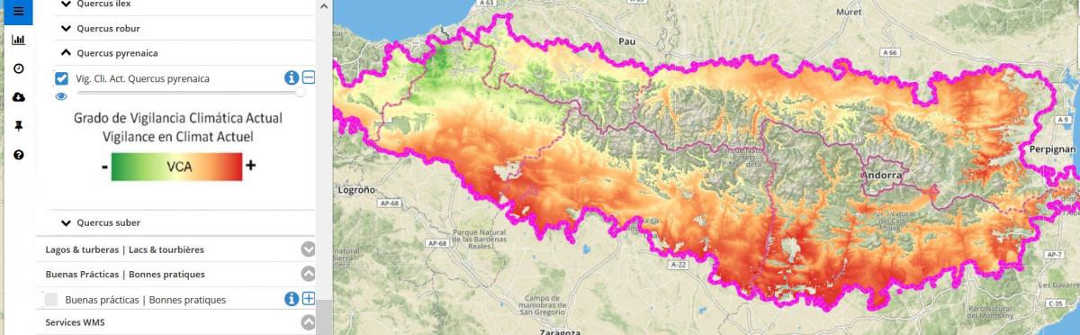
The interactive map also shows the different floral and phenological (study of the occurrence of seasonal events in living beings) monitoring stations in the Pyrenees and the current states of climatic vigilance for different tree species such as black pine or tauzin oak.
Current climate vigilance state for tauzin oak:
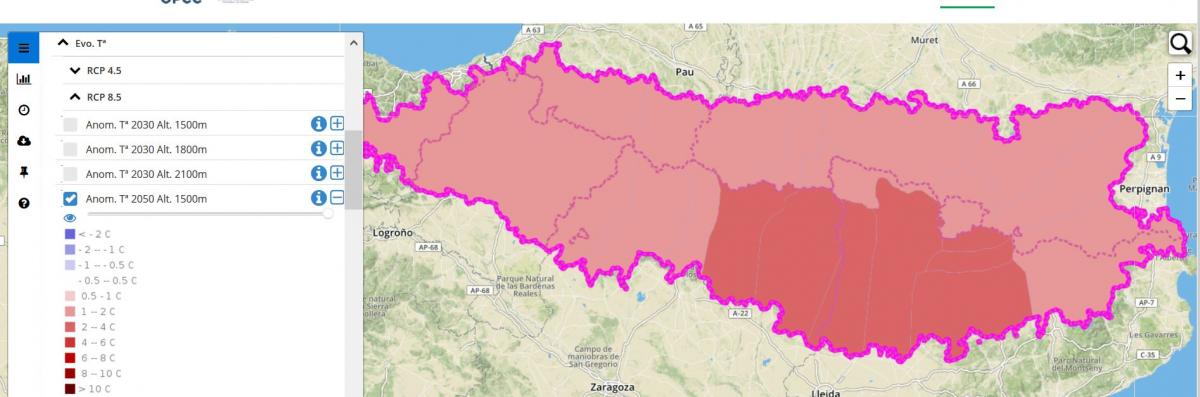
On the other hand, this tool features data from the past with the use of measurements dating back to 1981, data from the current climate and also forecasts for the future climate, according to RCP 4.5 and RCP 8.5 scenarios for the concentration of greenhouse gases adopted by the IPCC (Intergovernmental Panel on Climate Change) at different altitudes in the mountain range. These two scenarios predict an average temperature increase of 1.8º and 3.7º respectively by 2080.
For example, here we can see the temperature evolution for an altitude of 1500m in the year 2050 for the RCP 8.5 scenario, the reddest areas indicating an increase of between 4 and 6º:
With this tool, the OPCC wants to directly involve the citizen and the socioeconomic stakeholders in the understanding of the climate of their territory, of the species that inhabit it and thus make them aware of the broad effects that climate change will have on the Pyrenean massif, with an increase in maximum temperatures, anomalies in rainfall, an increase in extreme climate phenomena and the consequences for biodiversity and socioeconomic sectors.
You can consult the geoportal and enter the indicators of interest for you at the following link: https://www.opcc-ctp.org/es/geoportal
The geoportal has been completed thanks to ERDF funds through the POCTEFA program in the framework of the OPCC2 project.


PYRENEAN CLIMATE CHANGE OBSERVATORY
Avenida Nuestra Señora de la Victoria, 8
22.700 - Jaca
Huesca - España
+34 974 36 31 00
info_opcc@ctp.org