The aim of the MONTCLIMA project is to provide the best tools and replicate best practices in the fight against climate change and the management of natural risks in the SUDOE territories (Interreg V-B South-West Europe cooperation programme).
The project has developed and tested a strategy to strengthen resilience to natural and climate risks in the mountainous areas of the SUDOE territories. Its mission is to capitalise on the good results and best practices developed in the past in order to transfer their application to the whole of the Southwest European cooperation area.
In addition to the CTP, which is the lead partner, the other project partners are: CREAF, CESEFOR, NEIKER, CIM of Leiria, Polytechnic Institute of Bragança (IPB), CEREMA, Office National des Forêts (ONF), the Institut D'estudis Andorrans - CENMA and FORESPIR.
Learn more about the MONTCLIMA pilot cases here:
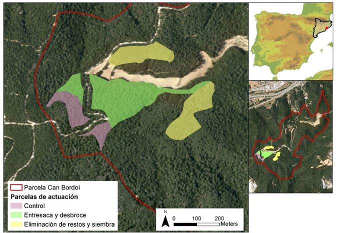
This pilot test has been carried out in a Mediterranean holm oak forest in the Montnegre-Corredor Natural Park (Catalonia, Spain) with the aim of reducing the vulnerability of the forest to fire risk. The experimental trial consisted of applying adaptive forest management measures in a Strategic Management Point (SMP) for the control of large forest fires.
In Andorra, the Pyrenean Country, forests occupy more than 40% of the territory and play a fundamental role in the prevention of risks such as landslides, snow avalanches or torrential lava flows. Therefore, the development of mitigation strategies is very important and can be carried out through the study and analysis of natural disasters, but also through the assessment of their impacts. In Andorra, as in many mountain territories, risk reduction strategies focus on a multi-risk approach to the actions to be implemented, since, for example, a forest for protection against falling blocks is also subject to the risk of fire.
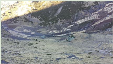
This pilot action, also developed in Andorra, aims to mitigate the risk of flooding and torrential lava flows in the Madriu-Perrafita-Claror valley. The pilot area is located in the culminating zone of a UNESCO-protected site. This area is dominated by gullies and rocky outcrops with some patches of sparse vegetation. During heavy rainfall events, mudflows often affect populations directly and indirectly. In particular, this site has suffered numerous drinking water supply cuts, due to incidents caused by mudflows in the water treatment plant downstream.
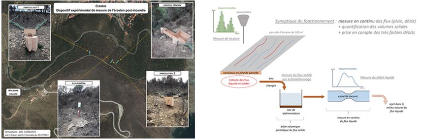
Forest fires are an increasingly important problem in the mountains of the Mediterranean region. Rainfall occurring shortly after a fire can cause significant damage in terms of runoff volume and transport of materials. In this MONTCLIMA pilot case, firstly, a study was carried out on the impact of fires on forest vegetation and its consequences on erosion and torrential hazards. Secondly, an initial assessment was made of the impact of a major fire that occurred in the municipality of Monze (Aude department) on 14 August 2019.
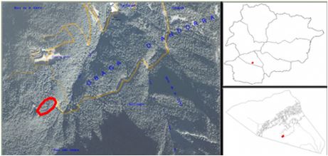
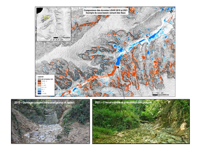
In January 2020, the eastern part of the Pyrenees mountain range was swept by the storm Gloria, which provided an opportunity to deepen our knowledge of erosion phenomena during torrential rains within the framework of MONTCLIMA. The ONF-RTM partner is monitoring a large number of sites in the Pyrénées-Orientales department. One of them is located in the catchment area of the Baillemarsanne torrent (tributary of the Têt river).
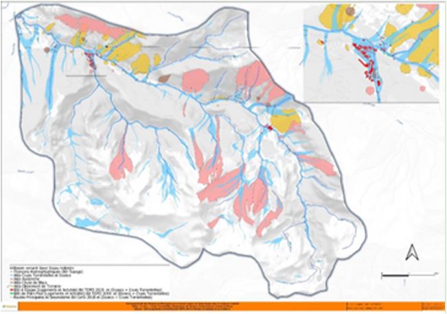
The Valentin valley, located in the commune of Eaux-Bonnes in the western French Pyrenees, is an area where all types of natural hazards converge. It is therefore an ideal pilot case for the definition of multi-hazard strategies to increase the resilience of a mountain territory. The first step in this case study was the definition of a detailed inventory of the different risks that converge in this territory. This required the identification, collection and aggregation of information from historical avalanche reports, press articles, archives and registers, as well as from the events database of the French state service RTM/MTES and from testimonies or witness statements.
Visit HERE the official website of the project
Consult HERE more audiovisual contents of the project


PYRENEAN CLIMATE CHANGE OBSERVATORY
Avenida Nuestra Señora de la Victoria, 8
22.700 - Jaca
Huesca - España
+34 974 36 31 00
info_opcc@ctp.org